25 Fun and Interesting Facts About Juneau, Alaska

Juneau is Alaska’s capital, one of the largest state capitals by area, and one of the few U.S. capitals you cannot reach by road. But that is only the beginning. After visiting Juneau several times, we became fascinated by the city’s unusual geography, gold-rush history, glaciers, Native heritage, and surprising local details. In this article, we share 25 fun and interesting facts about Juneau, Alaska, all carefully verified and chosen because they reveal something genuinely distinctive about the city.
This article may contain affiliate / compensated links. For full information, please see our disclaimer here.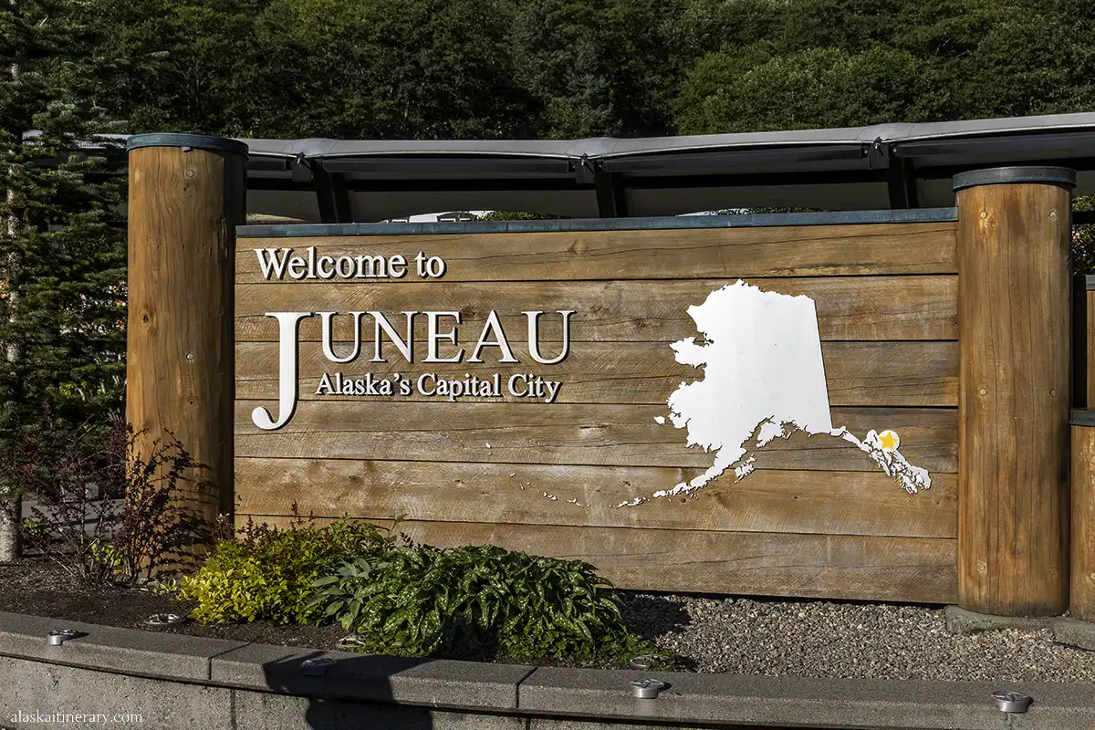
Why These Juneau Facts Are Worth Knowing
I decided to write this article after realizing how many readers were surprised to learn that Juneau—not Anchorage—is Alaska’s capital.
With a journalism background, I’ve always enjoyed digging deeper into the places we visit. History, geography, local culture, and small details often explain why a destination looks and feels the way it does today.
If you’re planning a trip to Juneau, knowing a few of these facts can make the city even more interesting once you arrive.
Below are 25 carefully verified facts about Juneau that we found especially interesting, surprising, or useful to know before visiting.

1. Juneau Is Alaska’s Capital, but It Wasn’t Always
Juneau has served as Alaska’s capital since 1906, when the territorial government was moved from Sitka.
Sitka had been the center of government since Russian America, so the move to Juneau reflected the growing importance of the new gold-mining settlement.
Juneau remained the capital when Alaska became a territory in 1912 and again when it became a state in 1959.
2. You Cannot Drive to Juneau
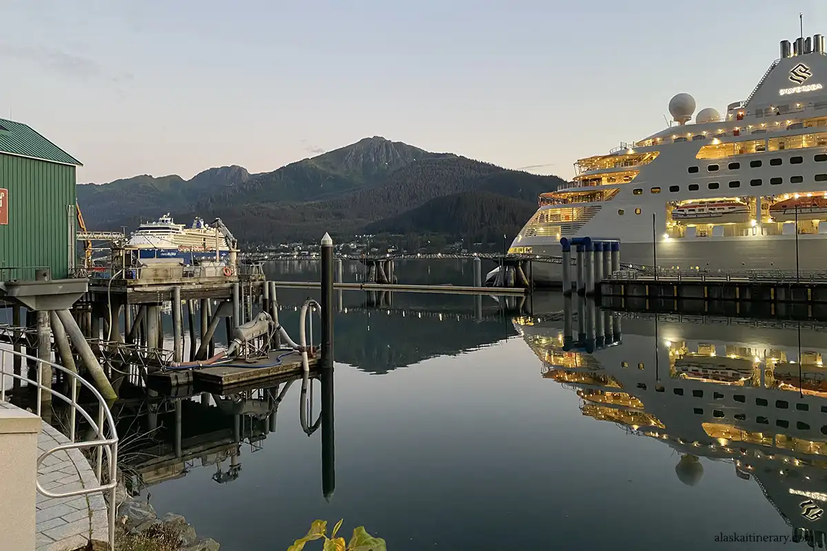
Juneau sits on the Alaska mainland, but there is no road connecting the city with the rest of Alaska or Canada. You can reach Juneau only by air or water.
That makes Juneau especially unusual for a state capital. The local road system still stretches well beyond downtown, but it eventually ends rather than connecting to another community. Glacier Highway runs roughly 40 miles north of downtown before the road network stops.
For travelers, that means arriving to Juneau by plane, cruise ship, private boat, or Alaska Marine Highway ferry rather than by car.
3. Juneau Is the Largest U.S. State Capital by Area—but Has Only About 31,600 Residents
The City and Borough of Juneau covers about 3,255 square miles, making it the largest state capital in the United States by total area. Yet only about 31,600 people live there year-round, placing Juneau among the less-populated state capitals.
Only about 2,704 square miles are land, with the rest made up of water.
What makes this especially surprising is that most of that enormous area is undeveloped wilderness, mountains, glaciers, and forest rather than dense urban development.
4. Juneau Is the Only U.S. State Capital That Borders Another Country
The City and Borough of Juneau shares its eastern boundary with British Columbia, Canada, making Juneau the only U.S. state capital that borders another country.
The international boundary crosses the mountainous terrain and icefields east of the populated parts of Juneau, so you would never realize how close Canada is while walking around downtown.
That makes Juneau unusual in two ways: you cannot drive from the city into Canada, even though the borough actually borders it.

5. Juneau Had Two Other Names Before It Became Juneau
Before it was officially called Juneau, the growing mining settlement went through two other names: Harrisburg and Rockwell.
Richard Harris first named the new mining district Harrisburg after himself in 1880. In early 1881, residents changed the name to Rockwell, honoring U.S. Navy commander Charles Rockwell. By the end of that year, the town was renamed Juneau after prospector Joe Juneau.
The U.S. Post Office made Juneau the official name in 1882.
6. Juneau Was Named After Gold Prospector Joe Juneau
The city takes its name from Joseph “Joe” Juneau, one of the prospectors involved in the 1880 gold discovery that led to the settlement’s rapid growth.
The story behind the name is surprisingly personal. According to the City of Juneau’s historical record, Joe Juneau complained that nothing in the new mining district had been named for him and gathered enough support from local miners to have the town renamed in his honor in 1881.
7. Tlingit Leader Kaawa.ée Helped Lead Prospectors to Juneau’s Gold
Juneau’s gold-rush story did not begin with Joe Juneau and Richard Harris alone. In 1880, Áak’w Tlingit leader Kaawa.ée—also recorded historically as Kowee or Cowee—helped guide the prospectors to gold-bearing areas near what is now Juneau.
Kaawa.ée and other Tlingit people showed them gold in Silver Bow Basin, where Harris and Juneau later staked claims. This discovery helped trigger the settlement that became modern Juneau.
It is an important part of Juneau’s history because older retellings often focus almost entirely on the two prospectors, while Tlingit knowledge of the land played a crucial role in leading them to the gold.

8. Juneau’s Gold Discovery Sparked Alaska’s First Major Gold Rush
The 1880 discovery at Gold Creek and Silver Bow Basin is considered the first major gold discovery in Alaska. News spread quickly, and prospectors began arriving in the new mining camp within weeks.
By the end of 1880, Juneau was already attracting miners, and the settlement grew rapidly around the new gold district. The discovery helped establish what became the city of Juneau and marked the beginning of large-scale gold development in the area.
9. Juneau’s Tlingit Name Is Dzántik’i Héeni
The Tlingit name associated with Juneau is Dzántik’i Héeni, traditionally connected with Gold Creek and the area around today’s downtown. The name is commonly translated as “Water Where Flounders Gather” or “Creek at the Base of a Hill Shaped Like a Flounder.”
Gold Creek was an important fishing area for the Áak’w Tlingit long before Juneau developed as a mining town. Historic records describe fish camps and smokehouses near the creek, which helps explain why this place name remains so significant.
10. Juneau Lies in the Traditional Homelands of the Áak’w Kwáan and T’aaku Kwáan
Long before Juneau became a mining town or Alaska’s capital, this area was home to Tlingit people who had lived here for generations.
Today, the City and Borough of Juneau recognizes the community as being built on the traditional homelands of the Áak’w Kwáan and T’aaku Kwáan Tlingit peoples.
Their connection to the land, waterways, fishing areas, and seasonal camps remains an essential part of Juneau’s history and identity.
11. Juneau and Douglas Became One Unified City and Borough in 1970
Modern Juneau was created on July 1, 1970, when the City of Juneau, the City of Douglas, and the Greater Juneau Borough officially unified into the City and Borough of Juneau.
That merger explains why Juneau today covers such a large area and includes communities on both sides of Gastineau Channel, including Douglas Island.
12. Alaska’s Capitol Building Wasn’t Built as a State Capitol
The building that serves as the Alaska State Capitol today was originally completed in 1931 as a Federal and Territorial Building. It housed the territorial legislature along with federal offices, courts, the post office, and other government functions.
When Alaska became a state in 1959, ownership of the building was transferred from the federal government to the new state, and it became the official State Capitol.
That history helps explain why Juneau’s Capitol looks quite different from many state capitol buildings around the country.

13. Juneau Was Home to the World’s Largest Hard-Rock Gold Mining Complex
Across Gastineau Channel on Douglas Island, the Treadwell Mining Complex grew into the world’s largest hard-rock gold mining operation in the early 1900s. At its peak, the complex included four major mines and employed around 2,000 people.
The operation was especially important between 1911 and 1917, when it ranked as the largest of its kind in the world and used some of the most advanced mining technology of the era.
Much of the complex was lost after a major 1917 cave-in flooded three mines, but parts of the historic site can still be explored today on Douglas Island.
14. The Juneau Icefield Covers About 1,500 Square Miles
Rising behind Juneau, the Juneau Icefield spans roughly 1,500 square miles of snow and ice and feeds dozens of glaciers throughout the surrounding mountains.
The icefield also crosses the international border into British Columbia, Canada, although most of it lies in Alaska. From Juneau, you can see parts of this enormous frozen landscape on flightseeing tours or explore one of its outlet glaciers, including Mendenhall Glacier.
15. Thirty-Eight Large Glaciers Flow From the Juneau Icefield
The Juneau Icefield feeds 38 large glaciers, including well-known names such as Mendenhall, Taku, Herbert, and Lemon Creek Glacier.
These glaciers flow down from the icefield through surrounding mountain valleys, creating one of the most dramatic glacial landscapes in Southeast Alaska.
Mendenhall Glacier is the easiest for most visitors to reach, but flightseeing tours reveal just how many glaciers are hidden beyond the city.
16. Mendenhall Glacier Is About 13 Miles Long
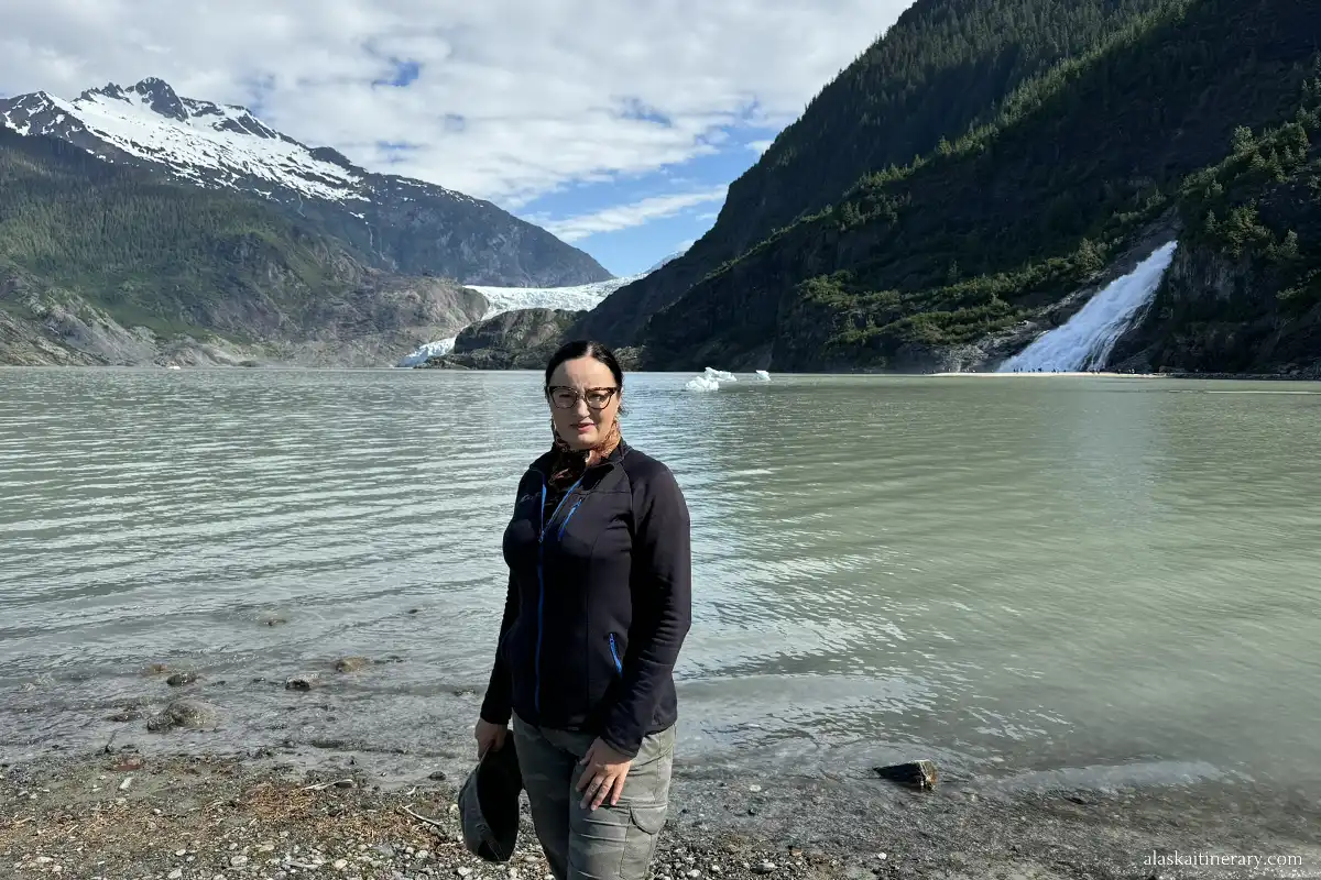
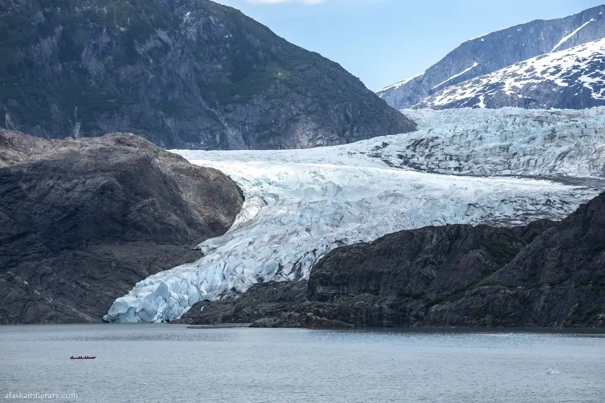
Mendenhall Glacier stretches for about 13 miles from the Juneau Icefield to Mendenhall Lake. As the ice slowly moves downhill, it grinds bedrock, carries boulders, and reshapes the landscape along the way.
What makes Mendenhall especially remarkable is how accessible it is. Visitors can reach the recreation area by road from Juneau and see one of the Juneau Icefield’s major outlet glaciers without needing a flightseeing tour or backcountry expedition.
17. Mendenhall Had the First U.S. Forest Service Visitor Center in the Country
The Mendenhall Glacier Visitor Center was dedicated in 1962 and became the first visitor center in the U.S. Forest Service system.
The original building was designed mainly as an observatory where visitors could get out of the rain and look across Mendenhall Lake toward the glacier. Over time, it expanded into a much larger interpretive center with exhibits, films, ranger programs, and glacier-viewing areas.
That makes Mendenhall notable not only for its glacier, but also for its place in the history of public lands and outdoor interpretation in the United States.
18. At Mendenhall, You Can Walk on Land That Was Covered by Ice Only Decades Ago
One of the most fascinating things about visiting Mendenhall Glacier Recreation Area is realizing that some of the ground beneath your feet was still covered by glacier ice only a few decades ago.
As Mendenhall Glacier has retreated, it has exposed new land where plants gradually move in and forests begin to develop. Trails around the recreation area let you see different stages of this process, from recently exposed ground to areas already covered with shrubs and young trees.
19. Taku Glacier Advanced for About a Century Before Beginning to Retreat
While many glaciers around the world were retreating, Taku Glacier advanced for most of the 20th century, making it unusual among Alaska’s major glaciers.
USGS research shows that the glacier’s long advance ended when it began retreating in 2015 after a significant decline in mass balance.
Taku Glacier is also the main outlet glacier of the Juneau Icefield and has been studied continuously for decades, making it an important site for understanding how glaciers respond to changing climate conditions.
20. Scientists Have Monitored Lemon Creek Glacier Since 1953
Lemon Creek Glacier has been studied continuously since 1953, making it one of North America’s longest-running glacier monitoring sites. The measurements began under the Juneau Icefield Research Program and continue today.
Its long record is especially valuable because scientists can compare changes in snow accumulation, ice loss, runoff, and glacier mass over many decades. USGS describes it as having the second-longest continuous glacier mass-balance record in North America.
Lemon Creek Glacier sits at the southern end of the Juneau Icefield, only a few miles from the city.

21. Juneau Is Surrounded by America’s Largest National Forest
Juneau sits within the vast landscape of the Tongass National Forest, the largest national forest in the United States. The Tongass covers about 16.7 million acres across Southeast Alaska and includes temperate rainforest, mountains, glaciers, fjords, and thousands of islands.
For visitors, that means wilderness is never far away. Many of Juneau’s hiking trails, recreation areas, and glacier landscapes are surrounded by or connected to Tongass National Forest lands.
22. Juneau Sits in a Temperate Rainforest
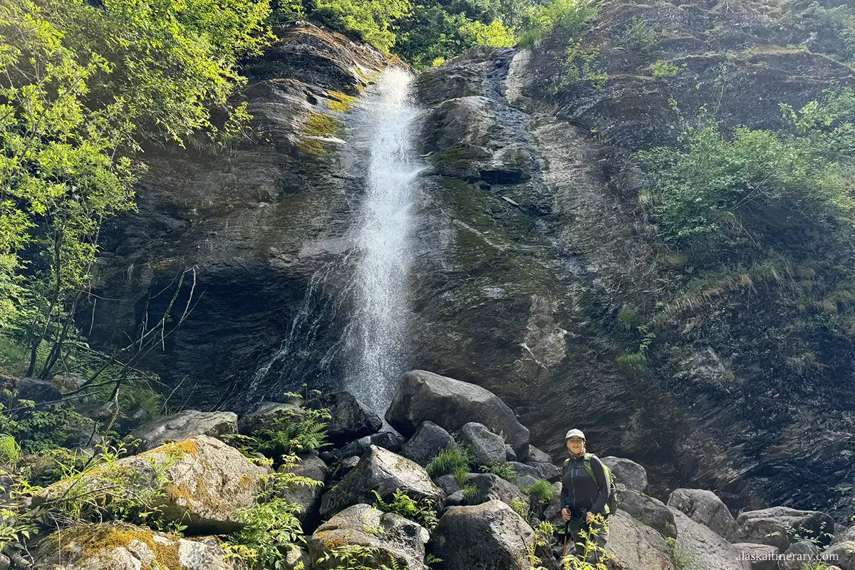
Juneau is part of Southeast Alaska’s coastal temperate rainforest, a cool, wet ecosystem shaped by the Pacific Ocean, frequent precipitation, and relatively mild temperatures.
That climate supports dense forests of Sitka spruce and western hemlock, along with mosses, ferns, and other moisture-loving plants.
This is one reason Juneau can feel so lush and green in summer, even though glaciers and snow-covered mountains rise just beyond the forest.
23. Juneau Has More Than 250 Miles of Hiking Trails
Juneau has more than 250 miles of hiking trails, an impressive amount for a city with such a limited road system. The trails range from easy rainforest walks to steep mountain routes with views over glaciers, channels, and surrounding peaks.
Some of the best-known options include Perseverance Trail, Mount Roberts Trail, Nugget Falls, the Rainforest Trail, and trails around Mendenhall Glacier.
For visitors who want to hike near Mendenhall, see our guide to the best hiking trails in the Mendenhall Glacier area.
24. Juneau Gets More Than 18 Hours of Daylight—but Not the Midnight Sun
Juneau’s summer days are remarkably long. Around the summer solstice, the sun rises at about 3:51 AM and sets around 10:09 PM, giving the city approximately 18 hours and 18 minutes of daylight.
However, Juneau does not experience the true midnight sun found farther north in Alaska. The sun still sets, although the long evening twilight can make summer nights feel surprisingly bright.
The contrast is dramatic in winter, when Juneau gets only about 6 hours and 21 minutes of daylight around the winter solstice.
25. Rainfall Can Vary Dramatically Across Juneau
Juneau is famous for wet weather, but rainfall is not the same across the city. The surrounding mountains create strong local differences in precipitation.
The National Weather Service identifies the downtown Juneau and Gastineau Channel area as the city’s wettest “rain belt,” where average precipitation can be about 50–65% higher than at Juneau International Airport.
That means two places only a few miles apart can experience noticeably different weather totals—another reminder of how strongly Juneau’s mountains and narrow coastal geography shape its climate.

Final Thoughts on These Juneau Facts
Juneau is much more than Alaska’s capital. Its unusual geography, Tlingit heritage, gold-rush history, massive icefield, and surrounding temperate rainforest make it one of the most distinctive cities in the United States.
Today, most travelers experience Juneau as an Alaska cruise port. The city receives roughly 1.6–1.7 million cruise passenger visits during a recent cruise season, an enormous number for a community of only about 31,600 year-round residents.
If Juneau is one of the stops on your cruise, explore our Alaska Cruise Planner for help choosing shore excursions, planning your time in each port, understanding cruise-port logistics, and preparing for your Alaska cruise.
Do You Like It? Pin It For Later!