
Alaska Regions Explained: Southeast, Southcentral, Interior, Southwest & Far North

Alaska is divided into regions for a reason. The state is vast, geographically complex, and shaped by coastlines, mountain ranges, climate zones, and transportation networks. These regional boundaries help explain why travel works smoothly in some areas and requires careful planning in others. Understanding Alaska’s regions is one of the most important steps in trip planning. Regions define how you get around, how far you can realistically travel, and what kind of experience to expect. Some areas are road-based and flexible. Others rely on ferries or flights and function very differently on the ground. This guide explains Alaska’s five main travel regions—Southeast (Inside Passage), Southcentral, Interior, Southwest, and the Far North—with a focus on geography and access. The goal is to give you a clear regional framework you can use across all stages of planning.
This article may contain affiliate / compensated links. For full information, please see our disclaimer here.
Our Experiences Traveling Across Alaska’s Regions
Over the years, we’ve traveled across all five Alaska regions using different modes of travel. Chris and I have driven long highway routes, explored road-connected areas by RV and car, relied on ferries in coastal regions, and flown to remote destinations where no roads exist.
Those experiences made one thing clear. Alaska regions function very differently on the ground. Distance, access, and transportation options change by region, and those differences shape every itinerary.
This guide is built on that firsthand understanding, with the goal of helping you plan realistically before choosing routes, timing, or Alaska destinations.
Agnes’ Advice: This article explains Alaska’s main travel regions and how they function on the ground. For planning an Alaska trip details, we also break down Alaska weather by region and explain the best time to visit Alaska based on different travel goals.
Why Alaska Is Divided Into Regions
Alaska’s regions reflect how the state actually functions, not arbitrary borders. Geography, transportation networks, and settlement patterns make it impossible to treat Alaska as a single travel zone.
The state spans more than 660,000 square miles. Mountain ranges, vast coastlines, islands, glaciers, tundra, and interior basins create natural divisions that shape climate, access, and infrastructure. These physical barriers influence where roads exist, where ferries operate, and where flights are the only option.
Transportation plays a major role. Some regions are connected by an extensive road system, while others have no road connections between towns. In Southeast Alaska, communities are linked by water and air. In Southwest Alaska and the Far North, many destinations are accessible only by small plane or boat.
Population patterns also matter. Most Alaskans live in Southcentral and Interior hubs, where services and infrastructure are concentrated. Other regions remain sparsely populated and operate on very different logistical realities.
These factors are why Alaska is divided into regions. Understanding them helps explain why travel looks easy in some areas and complex in others—and why planning always starts with knowing which region you’re in.
This infographic with a map shows 5 Alaska’s regions for planning purposes. Regional boundaries are approximate and used for orientation only.

Alaska Regions at a Glance
Before diving into each region, this overview shows how Alaska’s regions differ in geography, access, and travel structure. These distinctions matter more than distance on a map.
Alaska has five regions—Southeast (Inside Passage), Southcentral, Interior, Southwest, and the Far North (Arctic).

Use this table as a reference point. Each region below builds on these fundamentals and explains how geography and access shape travel on the ground. Choosing the right Alaska destinations is one of the most important decisions you’ll make, as it shapes your entire trip and how everything fits together.
Southeast Alaska (Inside Passage)
Southeast Alaska, often called the Inside Passage, is a narrow coastal region made up of islands, fjords, and steep rainforest-covered mountains. Key towns include Juneau (the capital of Alaska), Sitka, Ketchikan, Skagway, and Haines.
This region has no road connections between communities. You reach Southeast Alaska by cruise ship, ferry, or plane. Many travelers arrive on Alaska cruises sailing from Seattle or Vancouver, with some itineraries starting as far south as San Francisco or Los Angeles.
Independent travelers can also use the Alaska Marine Highway System, which operates ferries from Bellingham, Washington, and connects coastal towns throughout the region.
Southeast Alaska is shaped by the Pacific Ocean. Weather is generally mild compared to the Interior, but rain is frequent year-round and cloud cover is common. Snow can fall at sea level in winter, yet extreme cold is rare. These marine conditions influence everything from flight reliability to visibility on glacier and wildlife tours.
The region is culturally rich. Southeast Alaska is the ancestral homeland of the Tlingit, Haida, and Tsimshian, Alaska Native peoples. Their presence is visible in towering totem poles, clan houses, and living traditions of art, song, and dance.
Russian settlement also left a mark, most visibly through onion-domed Orthodox churches that still stand in towns like Sitka.
What Southeast Alaska Is Best Known For
- Marine-based travel, including Inside Passage cruises and ferry routes, since towns are not connected by roads.
- Tidewater glaciers, deep fjords, and dramatic coastal scenery shaped by the Pacific Ocean.
- Strong whale-watching opportunities, especially humpback whales that feed in the region during summer months.
- Rich Alaska Native heritage, with visible Tlingit, Haida, and Tsimshian cultural sites, totem poles, and living traditions.
- Tongass National Forest, the largest national forest in the United States and the largest intact temperate rainforest in the world.
- Glacier Bay National Park and Preserve, one of Alaska’s most glacier-dense national parks, primarily accessed by cruise ship or boat.
- Misty Fjords National Monument known for dramatic fjords, granite cliffs, waterfalls, and untouched rainforest landscapes.
Who Southeast Alaska Is Best For
- Alaska cruise travelers and ferry-based visitors who do not plan to rent a car.
- Travelers interested in coastal scenery, wildlife, and Alaska Native culture.
- Visitors comfortable with rain, cloud cover, and changing marine weather.
- Those planning point-to-point travel rather than loop-style road trips.

Southcentral Alaska
Southcentral Alaska is the state’s most populated and best-connected region. It includes Anchorage, Alaska’s largest city and main transportation hub. Anchorage airport has the strongest flight connections to the Lower 48, which makes it the most common starting point for land trips.
This region anchors Alaska’s road and rail network. Paved highways connect key destinations such as Seward, Homer, Whittier, Girdwood, Palmer, Wasilla, Talkeetna, and Valdez. It’s easy to explore those towns by car.
Southcentral is home to the Alaska Railroad, which runs 400 miles from Seward through Anchorage and north to Fairbanks, connecting Southcentral with Interior Alaska and popular stops along the way.
Southcentral combines coastal and mountain landscapes. Coastal areas tend to be cooler and wetter, while inland valleys are usually drier and warmer in summer. Weather can change quickly near mountain passes and along the coast, so day-to-day conditions matter.
Culturally, much of this broader region connects to the traditional homeland of Alaska Native peoples, including Athabascan communities in nearby inland areas and coastal Alaska Native cultures along the Gulf of Alaska.
What Southcentral Alaska Is Best Known For
- Alaska’s most flexible region for travel, with extensive road and rail connections.
- TScenic Alaska train rides
- Kenai Fjords National Park, known for tidewater glaciers and marine ecosystems near Seward.
- Wrangell–St. Elias National Park and Preserve, the largest national park in the United States, accessed primarily through Southcentral routes.
- Immediate access to mountains and wilderness through Chugach State Park and Chugach National Forest.
Who Southcentral Alaska Is Best For
- First-time Alaska visitors who want reliable infrastructure and flexible planning.
- Road trippers and independent travelers who prefer driving or rail travel.
- Travelers combining glaciers, mountains, coastal towns, and national parks in one itinerary.
- Visitors starting or ending longer Alaska land trips that extend into the Interior or Southwest.

Interior Alaska
Interior Alaska covers the vast inland area between the Alaska Range and the Arctic Circle. The region centers around Fairbanks, the main hub for travel, services, and flights. Smaller communities are scattered across long distances, often connected by a single highway or air routes.
This region operates very differently from coastal Alaska. Interior Alaska is land-based and distance-driven. Roads matter. Travel times are long. Towns are far apart. Planning always starts with mileage, fuel stops, and daylight.
Interior Alaska experiences the most extreme seasonal contrasts in the state. Summers can be warm and dry, while winters are long, dark, and very cold. At the same time, Interior Alaska offers some of the clearest skies in Alaska, which plays a major role in both summer visibility and Northern Lights viewing.
The region includes Denali National Park and Preserve, one of Alaska’s most iconic destinations. Access to Denali is tightly regulated. Private vehicles can only travel a short portion of the park road, while buses provide deeper access during the operating travel season. Many Interior itineraries revolve around Fairbanks and the Denali area as primary bases.
Interior Alaska is also closely tied to Alaska Native history. Much of the region is the traditional homeland of Athabascan peoples, whose cultures developed around river systems such as the Yukon and Tanana Rivers. That river-based geography still influences settlement patterns today.
What Interior Alaska Is Best Known For
- Large-scale wilderness and long-distance travel, where planning revolves around highways, hubs, and fuel availability.
- Denali National Park and Preserve, with wildlife viewing, vast landscapes, and limited-access park roads.
- Extreme seasonal contrasts, including very warm summer days and some of the coldest winter temperatures in Alaska.
- Strong Northern Lights viewing potential during the long, dark months outside summer.
- River systems and interior landscapes that feel remote even when accessed by road.
Who Interior Alaska Is Best For
- Travelers comfortable with long drives and fewer services between stops.
- Visitors who want to experience Denali and Interior wilderness rather than coastal towns.
- Aurora-focused travelers planning trips outside the summer months.
- Independent travelers who prefer road-based exploration over marine or cruise travel.
- Those interested in Alaska’s interior history, river cultures, and wide-open landscapes.
Interior Alaska rewards travelers who plan carefully and think in terms of regions and hubs, not short distances. It offers a very different Alaska experience—one defined by scale, silence, and seasonal extremes.

Southwest Alaska
Southwest Alaska is one of the most remote and logistically complex regions in the state. It stretches along the Alaska Peninsula and Bristol Bay and includes communities such as King Salmon, Dillingham, and Kodiak. There are very few roads, and most destinations are reached by small plane or boat.
This region is shaped by aviation-based travel. Visitors typically fly from Anchorage to a regional hub and then continue by bush plane to lodges, parks, or villages. Travel plans depend heavily on weather, visibility, and aircraft availability, so flexibility is essential.
Southwest Alaska is famous for its wildlife concentrations and intact ecosystems. The region supports massive salmon runs that draw large populations of brown bears. Coastal areas are influenced by the Bering Sea and the North Pacific, which bring frequent storms, fog, and rapidly changing conditions. Summers are generally cool, and winds can affect flight schedules.
Two major national parks define the region. Katmai National Park and Preserve is known worldwide for brown bear viewing at Brooks Falls during peak salmon runs. Lake Clark National Park and Preserve offers a mix of mountains, lakes, glaciers, and coastal habitats, with access primarily by air taxi.
Southwest Alaska feels remote even by Alaska standards. Most trips focus on one primary destination, rather than multi-stop itineraries. Distances are large, services are limited, and travel plans often revolve around weather windows.
What Southwest Alaska Is Best Known For
- Exceptional brown bear viewing tied to salmon runs, especially in Katmai and Lake Clark.
- Remote national parks with limited access and low visitor numbers.
- Aviation-based travel using bush planes and floatplanes.
- Bristol Bay’s globally important salmon fisheries and ecosystems.
- Wild, undeveloped landscapes with minimal infrastructure.
Who Southwest Alaska Is Best For
- Travelers focused on wildlife viewing, especially bears.
- Visitors comfortable with flying in small aircraft and weather-related delays.
- Those planning single-destination trips rather than road-based itineraries.
- Experienced Alaska travelers looking for remote and less-visited regions.
- Photographers and nature-focused travelers who prioritize wilderness over convenience.
Southwest Alaska offers some of the most powerful wildlife experiences in the state, but it requires realistic expectations, flexible schedules, and careful planning.

Far North Alaska (Arctic)
Far North Alaska lies above the Arctic Circle and represents the state’s most extreme and remote region. The main hub is Utqiaġvik, the northernmost city in the United States. Outside of a few small settlements, vast stretches of tundra dominate the landscape.
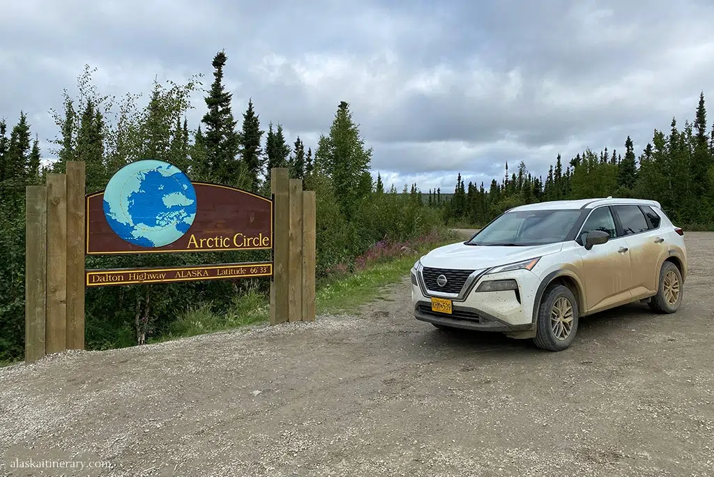
Access defines this region. Most travelers arrive by plane, often through Fairbanks. Limited road access exists along the Dalton Highway, which connects Fairbanks to Deadhorse near Prudhoe Bay. This road primarily supports industrial traffic and requires careful planning for fuel, weather, and road conditions.
The Far North experiences true Arctic conditions. Winters bring extended darkness during polar night, while summer offers 24-hour daylight. Temperatures remain cool even in summer, and strong winds can affect travel at any time. Weather and daylight shape every decision here.
This region includes Gates of the Arctic National Park and Preserve, the least visited national park in the United States. The park has no roads, no trails, and no visitor facilities. Access happens only by air or long backcountry routes, making it one of the purest wilderness areas in North America.
The Far North is also the traditional homeland of the Iñupiat people. Their culture developed around Arctic survival, subsistence hunting, and coastal life. Today, cultural traditions remain closely tied to the land and sea.
What Far North Alaska Is Best Known For
- Arctic tundra landscapes and extreme seasonal daylight.
- Remote, roadless wilderness with minimal infrastructure.
- Gates of the Arctic National Park and Preserve, one of the most inaccessible parks in the country.
- The Dalton Highway and overland routes to the Arctic Ocean.
- Strong Indigenous presence and Arctic cultural heritage.
Who Far North Alaska Is Best For
- Experienced travelers seeking true Arctic conditions.
- Visitors comfortable with limited services and strict logistics.
- Adventure-focused travelers planning fly-in or expedition-style trips.
- Those interested in Arctic culture, geography, and wilderness.
- Travelers who prioritize remoteness over convenience.
Far North Alaska offers a raw and demanding experience. It rewards travelers who plan carefully and understand that access, weather, and daylight shape every aspect of travel in the Arctic.
How to Choose the Right Alaska Region for Your Trip
Once you understand how Alaska is divided, choosing the right region becomes much easier. The key is to start with how you want to travel, not how many places you want to see.
If you prefer easy logistics, road access, and flexibility, Southcentral Alaska is the best starting point. It supports road trips, rail travel, and multi-stop itineraries, and it connects well with other regions.
If your focus is coastal scenery, culture, and marine wildlife—and you do not plan to rent a car—Southeast Alaska (Inside Passage) fits best. Travel here follows water and air routes rather than highways.
For vast landscapes, long drives, and strong seasonal contrasts, Interior Alaska offers a land-based experience centered around hubs like Fairbanks and Denali. Distances matter more than attractions.
If wildlife is the main priority, especially bear viewing, Southwest Alaska stands out. Trips here are destination-focused and require flights and flexible planning.
For true remoteness and Arctic conditions, the Far North delivers an expedition-style experience. Access is limited, and planning revolves around weather, daylight, and logistics.
Every Alaska trip works better when you commit to one or two regions instead of trying to cover the entire state. Regions define access, pace, and expectations—and choosing the right one sets the foundation for a successful itinerary.
Final Thoughts
Alaska is not a single travel destination. It is a collection of regions that function very differently on the ground. Geography, access, climate, and infrastructure shape every trip long before activities come into play.
Understanding Alaska’s regions helps you plan realistically. It explains why some trips work well by car, others by ship or plane, and why distances and logistics matter more here than in most places.
This regional framework is meant to guide your next planning steps. Once you know where in Alaska you want to travel, decisions about timing, weather, activities, and routes become much clearer—and far more achievable.
From here, you can dive deeper into seasons, weather patterns, or region-specific guides, using this article as the foundation for smarter Alaska trip planning.
Do You Like It? Pin It For Later!


Alaska looks so stunning! I can’t wait to see it one day. Thanks for the tips!
As someone who has never been to Alaska, this post was super insightful. I really had no idea how many diverse areas there are in the state, but I guess it makes sense given how large it is. That’s super cool that you’ve been able to make it to all of the regions, I hope to as well someday.
I have always wanted to visit Alaska and did not know any of this! It feels like now i can pick out where to go in Alaska as a first timer!
This was so helpful! I’m hoping to visit Alaska, but didn’t really know where I should stay.